Farewelled Charlie and stocked up at the Finck store – spaghetti and tuna, cake, bread and lollies. Do you see a theme here? Carbohydrates!
I really enjoyed discussing black/white relations and options with Charlie. He gave me much to think about.
Immediately on leaving the gates of Finck township the road deteriorated into corrugations. This continued on and off for the first 30 km to the New Crown turnoff. After turning south on to the Mount Dare road the corrugations gave way to long stretches of loose sand. Walk.
About 10 km south of New Crown there is a gate. Going through the gate I noticed that a screw holding the upper strut of the rear pannier rack had pulled loose (probably worked loose and then stripped the thread). My spare 5M bolts were too short to get through the mount and fit a nut so used some gaffer tape to hold the loose screw in the hole and rode on. Again, a lonely feeling having brakedowns in isolated country.
The road was interesting, especially in the southern part where part of the road ran next to a channel which may have been the eroded remains of the old road. The last 10 km of the day ran through flood-out country (dead flat, no real drainage channels) with eucalypt woodland. Pretty and surprizingly moist for the edge of the desert.
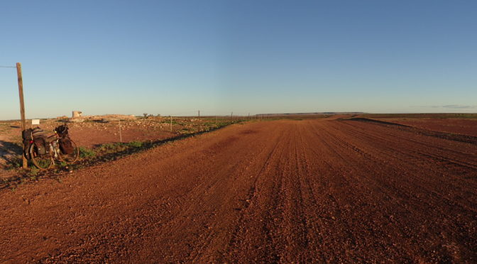
Finished just past the ruins of the old Charlotte Waters telegraph station. The buidings have been taken apart and the materials presumably reused on other structures on neighbouring properties. Just emphasises how scarce and expensive building materials were in the inland in the late 1800’s.

Half a kilometre past the ruins is the turnoff to the either Dalhousie Springs or Eringa Water hole which is supposed to be beautiful. After checking with the legs I turned left to Dalhousie Springs and Charlie’s family country.
Almost immediately Charlotte Waters (a huge mile long, 50 m wide waterhole) came into view. From the ruins all that is seen is a modest line of trees. Up close is a magnificent permanent waterhole.

I camped 50 m back from the edge of the waterhole to keep away from the mosquitoes. The ground above the flood line is a gibber plain. Examination of the stones reveals that many of the quartz/flints etc are actually aboriginal flaked knives and other tools. Thousands of ’em.