Left Warburton with an escort (briefly) of three primary school kids wagging school for a bit of motorbike riding up the GCR.
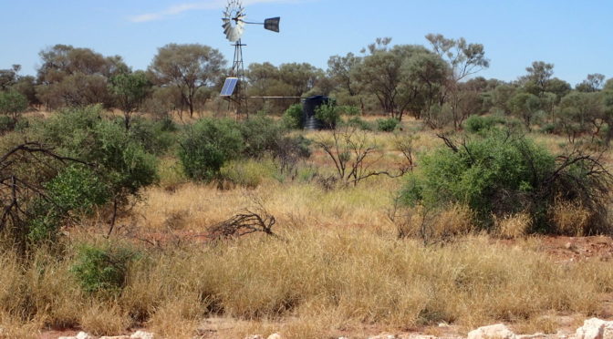
The road quickly deteriorates into a moderately rocky older style road as it heads up the Warburton Range. At the top of the range at the junction with the little-used Jackie Junction road is this seemingly new water supply. There is a trough so it works as a stock water but it is nicely positioned to provide water to travellers from Jackie Junction, or thirsty cyclists. The lack of minerals on the overflow suggests that the water is good quality although I didn’t try it.

The road improves after descending the Warburton Range although parts could do with grading to remove the rills of loose gravel.
At the rocky outcrop below I had a close pass by the cyclist’s worst enemy; grey nomads with a wide caravan and little appreciation of how unstable a bicycle can be on loose sand or gravel. Scary. I left the nomads to camp below the bluff and camped another few kms up the road myself.
